REQUEST FOR PROPOSALS TO PROVIDE PROFESSIONAL SERVICES FOR wetland and stream restoration, construction planning, and design services
Date of Advertisement: April 1, 2024
Deadline for Receipt of Proposals: April 26, 2024
ShoreRivers seeks qualified vendors to provide professional services for design/build of a wetland restoration and stream restoration site in southern Cecil County, MD.
All prospective bidders may attend an optional site meeting 10am on April 19. Meeting point will be at the gravel lot on the junction of Christopher Road and the north side of Cecilton Warwick Road (39.40550278*; 75.83910000*). Bidders must RSVP to project manager Josh Thompson at jthompsonrestoration@gmail.com with intentions to attend the site meeting.
PROJECT DESCRIPTION
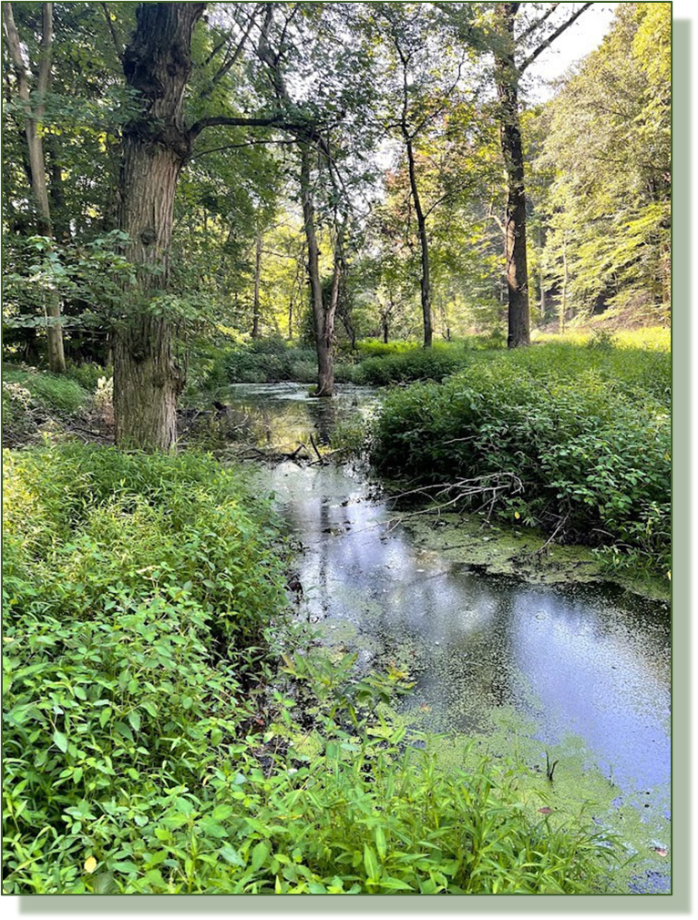
This project is part of a holistic nature-based approach to improve habitat and water quality practices on a large grain farm in southern Cecil County, bordering Black Duck Creek, a headwater tributary to Little Bohemia Creek. ShoreRivers completed an extensive wetland project on this site in 2020 with funding from the Chesapeake Bay Trust and the Maryland Department of Natural Resources, restoring wetlands in the four major drainages in the landscape as natural filters at the interface of agricultural production and the downstream perennial waterways in the headwaters of the Bohemia River. The wetlands were constructed within existing grassed waterways and incorporated a significant area of cropland into the project area in order to build a footprint large enough to provide treatment and storage for the 373-acre drainage area. The long-term conservation plan for this site included implementation of these upland wetland filters as a Phase I approach, with the intent of returning to restore the downstream degraded stream segments and floodplain wetlands under a Phase II project. After monitoring the success of the upstream work since its completion in 2020, and ensuring that the wetlands are fully stable, vegetated, and functioning as predicted, we are focused on restoring the critical downstream headwater habitat and floodplain function of three of the four drainages. Each of the three proposed stream segments are different and will incorporate a slightly different strategy for restoration (described below), but overall, this project will focus on restoring the hydrology and floodplain connectivity of a dynamic pre-development coastal plain headwater stream/wetland complex and will utilize a combination of restoration techniques to build a resilient, cost-effective project that will promote a dramatic upswing in ecological value, habitat, nutrient processing, and stormwater storage.
Site B: This site is downstream of the largest upland wetland practices and will have the greatest impact of the three proposed reaches. The upper 1,000 feet of this reach is a historic pond installed in the mid 1900s (no record at the Conservation District of the practice) by running a large berm across the stream valley and installing a primary spillway overflow pipe to control water levels. There was an emergency spillway installed on the south side of the pond that spills into the perennial stream below. Over multiple decades, this pond had filled with sediment and gradually grown in with scrub/shrub trees. The primary spillway pipe has failed, collapsing into a large sink hole, and the berm is failing at both the primary spillway and the emergency spillway—both are actively headcutting upstream into the historic sediment deposit in the pond basin. Within the basin, water flow moving through the failed primary spillway has formed a channel that is entrenched below the basin floor, acting as a stream channel that is disconnected from its floodplain and exacerbating the erosion and transport of sediment out of the pond and into the downstream floodplain of Black Duck Creek. Downstream of the berm, the primary spillway pipe is perched approximately 8 feet above the eroded stream channel below, and bank 3 height is 8–10 feet. There are two large, active headcuts migrating south into the field adjacent to the floodplain. There is also approximately 300 feet of perennial stream from the berm to a stable grade at the convergence with Black Duck Creek: this reach is entrenched and over widened to approximately half of the total floodplain width.
Site B Approach: The approach in this reach will be to remove the failed berm and excavate legacy sediment deposited in the pond basin in order to restore the full stream length to tie into the upstream constructed wetlands. Total sediment cut depth will be calculated within the design, but the team will consider reaching a stable and balanced stream valley slope from the existing wetlands to the tie-in point at Black Duck Creek, and may use a cascade or log step grade control to cascade the outflow of the wetlands to the proposed stream valley elevation. The design team will also work toward a balanced cut/fill for the overall Cecilton farm site, and any material removed will be transported to Site D for channel fill material. Downstream of the existing berm, the right side of the valley will be excavated to lower to the stable stream bed on the left valley wall. Cross valley grade control will be installed, and the entire reach will be planted with wetland tolerant shrub species and emergent plugs.
Site C: This reach is relatively short, totaling 700 feet from the constructed wetlands upstream to a stable point downstream at Black Duck Creek. There is an abandoned beaver dam near the downstream end of the reach and is currently beginning to destabilize and lose sediment stored in the upstream ponded area. There is approximately 0.5 acres of wetland habitat created by the beaver dam that will be lost when the dam fully breeches, along with the significant sediment stored in the upstream ponded area. Upstream of the abandoned beaver dam influence, the stream channel quickly becomes entrenched as the valley gains elevation, with 5–7-foot banks and a fully disconnected floodplain near the upstream wetland outfall. The stream valley is dominated by immature, invasive trees and shrubs.
Site C Approach: The approach proposed in this reach is to stabilize the existing wetland habitat created by the abandoned beaver dam by installing a permanent structure across the floodplain to hold the existing water levels and install a stable log step pool structure to safely convey overflow to the downstream streambed elevation. Upstream of the abandoned beaver dam influence, the team will balance floodplain cut and channel fill activity on 700 linear feet of stream valley, and work toward a stable valley slope and stream morphology until tie in with the water elevation at the stabilized abandoned beaver dam. The work in this reach will prioritize undersized bankfull elevation and promoting floodplain access, as well as floodplain grading to create shallow wetland habitat throughout. Cross valley grade control will be installed to prevent downcutting of the channel.
Site D: This 1,200-foot reach is typical of many forested ravines on the upper Eastern Shore, characterized by a severely degraded, incised, and overly widened condition, with heavy sedimentation, embedded substrate, and poor macroinvertebrate habitat throughout the system. Actively eroding streambanks, devoid of vegetation, and exposed, undercut root systems are typical throughout this stream. Severe outer meander bend geometry against highly erodible soils has caused collapsing ravine slopes through the upper reach. The lower system is surrounded by significant floodplain, but is disconnected through a combination of a legacy sediment deposits and incision of the stream channel due to erosive energy during storm events.
Site D Approach: As part of a strategic plan for the Cecilton Farm, the design team has phased the extensive work needed in a way that will allow balanced earthwork across the site, pairing this site’s need for significant fill material with the excess cut material that sites C and B will likely produce. The design for this reach will incorporate a regenerative stormwater conveyance (RSC) step pool system within the upper steep section, tying into a single channel design in the middle reach as the valley widens out into a broader floodplain. The middle section will incorporate some valley cut, and incorporate material from the adjacent sites (if the material is appropriate) to bring the channel to within 0.5’ of the floodplain elevation.
DELIVERABLES
The selected firms or partnerships will complete a fully constructable design. Proposal must include (but not be limited to) all assessment, permitting, modeling, survey, design, and nutrient calculation work to generate a ready-to-construct design. Deliverables to ShoreRivers will include:
Plan set versions submitted to project manager for review and approval at concept, 60%, 90%, and final
All local, state, and federal permits in-hand; coordinate pre-application meeting with project manager
Full itemized construction bid sheet with engineer’s estimate for costs
All assessment data including stormwater modeling, BEHI and NBS data, stream protocol calculations, soil sample lab results, etc. to be provided to the project manager
Full planting plan with species, container stock size, seed mixes, and guarantee and maintenance plan
Detailed construction sequence
Submittal & selection process
Interested firms shall submit their competitive proposals, to be received on or before 5pm on April 26, 2024, to: Kristin Junkin, kjunkin@shorerivers.org
Proposals may be submitted via email in PDF format. Applicants assume the risk of timely delivery. Any proposals received after the deadline will not be considered.
Responses shall include the following information that will be utilized by the selection committee to determine qualifications and rankings:
Expertise and experience in headwater wetland and stream restoration as outlined in this RFP.
At least three examples of completed projects within the past seven years, with a brief scope of project work, overall project cost, and contact for reference. Preferably include pre- and post-construction photos.
Demonstrated ability to perform the services outlined in this RFP.
Capacity to meet requirements of the contract, in addition to capacity to construct project if funded.
Project budget breakdown including all aspects of design, assessment work, permitting, survey, and follow-up. Budget should assume a full permitted, turn-key, ready-to-construct project design with all digital plans, design criteria, assessment work, modeling, and all applicable stream protocol and wetland credit calculations to be submitted to ShoreRivers as deliverables.
The submitted proposals shall be concise, not to exceed 10 pages (not including the cover page), 8.5” x 11”, printed on one side. The minimum font size shall be 10 point. Facsimile submittals will not be accepted.
Each response will be ranked by the selection committee, based on the evaluation criteria. The list of qualified candidates will then be narrowed to the highest-ranking firms based on the scoring results. The top-ranked firms may be interviewed individually, if deemed necessary, to discuss proposed project sites and design specifics. A final ranking will be made based on the interviews. If interviews are deemed necessary, elected firms will be given notice of times and dates for scheduled interviews, which will be held in-person. Negotiations will begin with the firm having the highest final ranking and will proceed until a selection or selections are made. All respondents will receive notice of contract award. ShoreRivers maintains the right to make the selection decision without conducting interviews.
Respondents are reminded that it shall be the responsibility of the engineering consulting firm to be current with any professional registrations or certifications as required by law to work in the project area. Additional certifications, such as Professional Wetland Scientist and Certified Ecological Practitioner, are preferred. The professional engineer for this work must have related experience in watershed restoration and coastal engineering.
The firm(s) awarded the contract will be required to enter into a professional services contract with ShoreRivers (standard contract available upon request).
License, Bond, and Insurance Requirements
Contractors must maintain and provide copies of the following:
Current Certificate of Liability Insurance
Workers Compensation Insurance, if required by law
Questions may be submitted to the project manager, Josh Thompson, at: jthompsonrestoration@gmail.com, 302-841-0176