
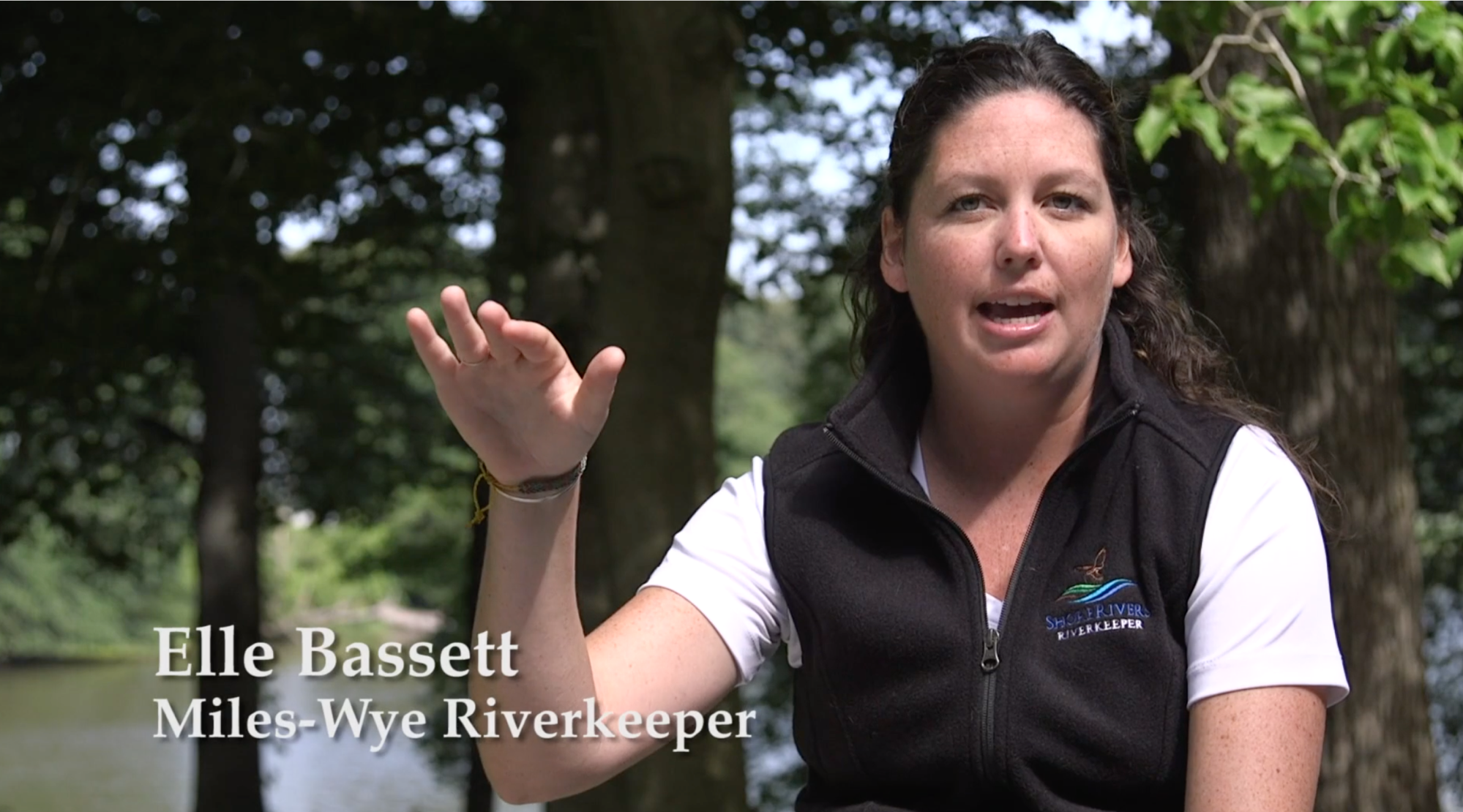
Miles-Wye Riverkeeper
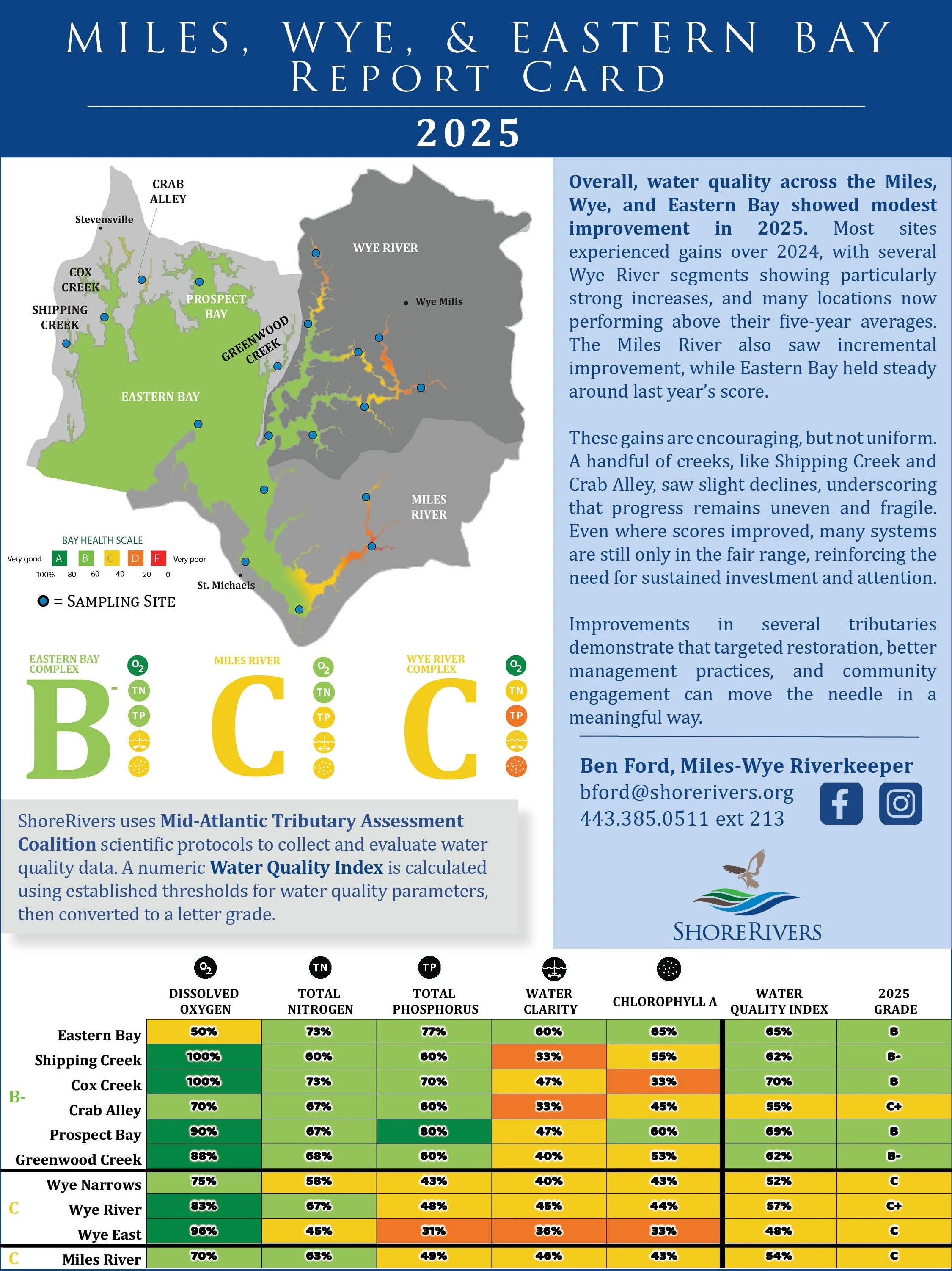
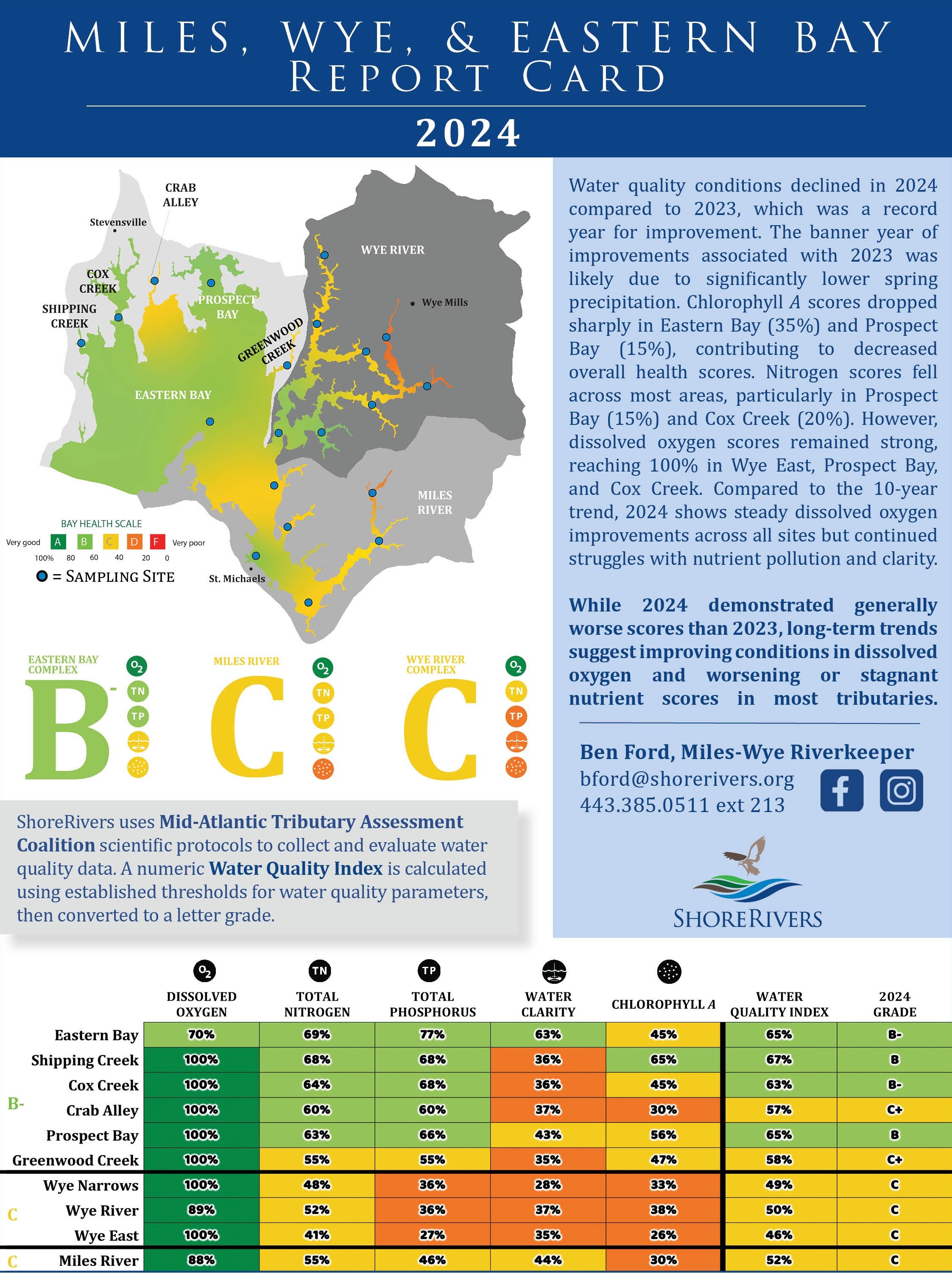
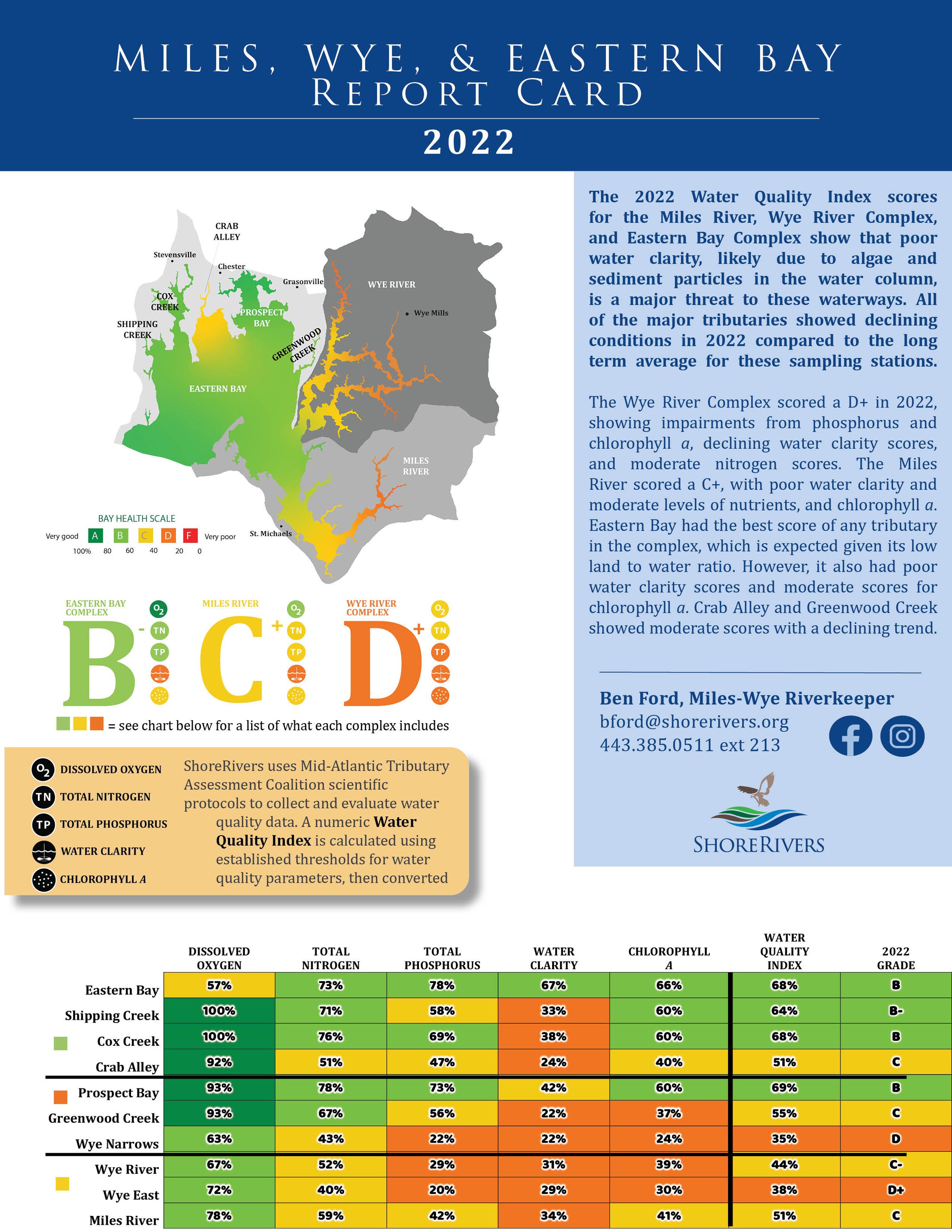
The Miles-Wye Riverkeeper works to protect and restore the waterways and tributaries of the Miles River, Wye River, and Eastern Bay.

The Miles and Wye rivers flow from narrow, rural headwaters and empty into Eastern Bay, which in turn is dominated by wide water lined with coves both rural and suburban in nature.
The Miles River comprises 54 square miles running past the town of St. Michaels, out into Eastern Bay, and up into Kent Island Narrows where it touches the Chester. The river is home to the historic town of St. Michael’s, the “town that fooled the British.” The Miles has and continues to play a vital role in the local community's way of life.
The Wye River includes the Wye East, the Wye Main Stem, and Wye Narrows, covers 78 square miles, and winds around historic Wye Island, a state preserve that includes a magnificent old-growth forest, walking trails, and picnic areas. While the Wye River is predominantly tidal, it receives little influence from the Miles River and Eastern Bay. This means its poor water quality is a result of the surrounding land use—rural farms, septic systems, and small suburban towns.

Eastern Bay comprises multiple smaller bays and creeks including Shipping Creek, Cox Creek, Crab Alley Bay, and Prospect Bay. The water quality in Eastern Bay is generally better than other rivers and tributaries due to the relatively small amount of land draining into the larger amount of water. The full watershed spans 112 square miles, most of which is open water.
All three bodies of water—Miles River, Wye River, and Eastern Bay—face threats from excessive fertilizers, outdated or non-functioning septic systems, unwise development, and sprawl. These rivers are dominated by waterfront properties, providing the opportunity to implement best management practices such as River-Friendly Yards and best available technology septic systems to improve local water quality.
The entire watershed hosts multiple species of submerged aquatic vegetation. Many of these grass beds serve as seed banks where the Department of Natural Resources harvests seeds to plant in other rivers to meet restoration goals. While this watershed has not yet reached its attainable goal of restored SAV acreage, we are dedicated to contributing to the effort through our own harvesting and planting program and volunteer monitoring program.
The Miles-Wye Riverkeeper, working with the entire ShoreRivers family, is dedicated to improving the water quality in these rivers and ensuring that they remain bountiful, safe, healthy, and beautiful.
Miles-Wye Videos

Technical Documents